This village, located at the bottom of the Tinée valley and threatened by the Blanquière undermined by water, is situated at an altitude of 1140 meters, surrounded by high peaks, some of which exceed two thousand meters. Saint Etienne developed thanks to its location and the confluence of two watercourses: the Tinée and its tributary the Ardon.
.
In Saint-Etienne, water has a specific dimension, and hikers will quickly understand this by strolling along the Tinée or passing the Pinatelle gondola station. Moreover, in this village, stones grow with the water. This is not a tall tale.
The tufa where mosses grow facilitates limestone deposits. The rock, through chemosynthesis, traps the plants, the mosses develop, and the tufa increases. Thus, stones grow. Water has always been a paradise for birds. Wagtails (they are nicknamed this because of their tail’s fluttering) walk along streams or rivers in search of food: insects, crustaceans, or small fish. The white-throated dipper or water ouzel is a rather surprising bird, walking underwater against the current, snatching food made of insects and mollusks along the way.
The riverbanks are dotted with trees: white alders, verrucose birch, black poplars, white willows, and osiers, the roots of which stabilize the banks. The willow, because of its bark which contains salicylic acid, is used in the manufacture of aspirin. There is water, a continuous current, and one can install mills.
In 1870, Saint Etienne de Tinée had five. The production of flour met the needs of a population living mainly in self-sufficiency. Communication routes would only really open with the beginning of the 20th century and the baron de Cessole’s passion for mountains and skiing. The river is a source of life, the cradle of fish and insects, each playing its role in the food chain.
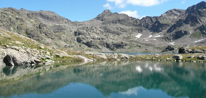
Unfortunately, humans came to disrupt it by upsetting the delicate balance of nature. We are over a thousand meters above sea level, surrounded by high peaks where high-altitude lakes lazily stretch out. In 1927, a bold project aimed to harness the hydrographic power of these lakes: Vens, Marie, and Ténibre. An access road was set up to facilitate the work of technicians.
The Second World War in 1939 led to the abandonment of this project. What remains is the energy path with its engineering works. At Saint Dalmas le Selvage, the waters are captured and brought by the Ublan canal, providing water to the eponymous district. Saint Etienne has many fountains, including the Bischoffsheim one dating back to 1898.
On its square, life and the major events of this village unfold. Opposite the Ardon torrent and near the Sainte Marie Madeleine chapel, another fountain dedicated to this saint adorns the village with its crystalline song. These are the two main ones.
The Ardon, a tributary of the Tinée, descends from the Demendols cattle ranch and is increased by the waters of the Pis de l’Aigo waterfall. Saint Etienne de Tinée is a story of water, for its benefit and misfortune. The landslide of the Clapière is its sword of Damocles. If the Tinée streambed were blocked by the Clapière, the village would certainly be engulfed.
This imposing mass of earth is monitored, and the Stéphanois, protected by their church and numerous chapels and oratories, some of which are masterpieces, live before fearing. It’s the expression of the faith of an entire village confident in its destiny.
Thierry Jan


